
Name:
50-V48-US3161
Latitude: N37°50.817'
Longitude: W119°30.637'
Elevation: 3308m
Location: May Lake
GPS Accuracy: 4m
Direction: 190
Photo Date: 8/4/2008
Time: 9:45pm
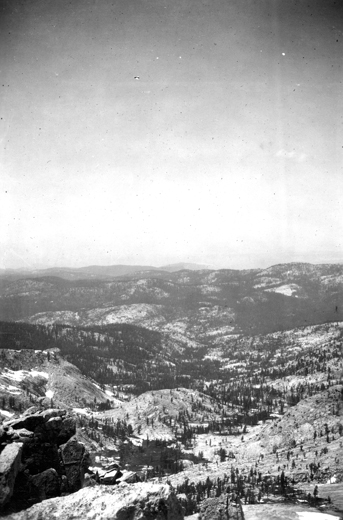
Latitude: N37°50.817'
Longitude: W119°30.637'
Elevation: 3308m
Location: May Lake
GPS Accuracy: 4m
Direction: 190
Photo Date: 8/4/2008
Time: 9:45pm

Vale (1994) Reference: 27
Photo Year: 1984
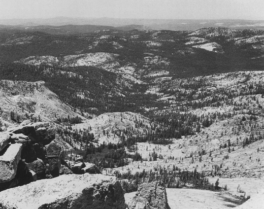
USGS Reference: 3161
Photographer: G.K. Gilbert
Year: 1907
Caption: Yosemite National Park, California. Upper basin of Yosemite Creek,
viewed from Mount Hoffman. Circa 1907.
Photo Credits: N.Wasserman (2008); Vale & Vale (1994). University of Utah Press; USGS
Inquires
- email the photographer