
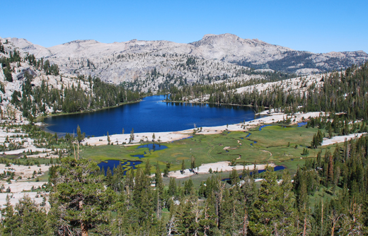
Name:
51-V49-US2073A
Latitude: N37°50.565'
Longitude: W119°25.038'
Elevation: 2918m
Location: Cathedral Lake
GPS Accuracy: 4m
Direction: 180
Photo Date: 8/3/2008
Time: 10am
Latitude: N37°50.565'
Longitude: W119°25.038'
Elevation: 2918m
Location: Cathedral Lake
GPS Accuracy: 4m
Direction: 180
Photo Date: 8/3/2008
Time: 10am
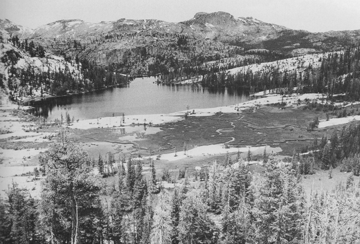
Vale (1987) Reference: 49
Vale (1994) Reference: 2
Photo Year: 1984
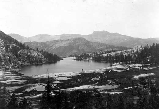
USGS Reference:
Photographer: G.K. Gilbert
Year: 1903
Caption: Yosemite National Park, California. Cathedral Lake, viewed from
the east. This is a typical rockN/Abasin lake, the bed rock being visible
all about its shores. 1903.
Photo Credits: N.Wasserman (2008); Vale & Vale (1994). University of Utah Press; USGS
Inquires
- email the photographer